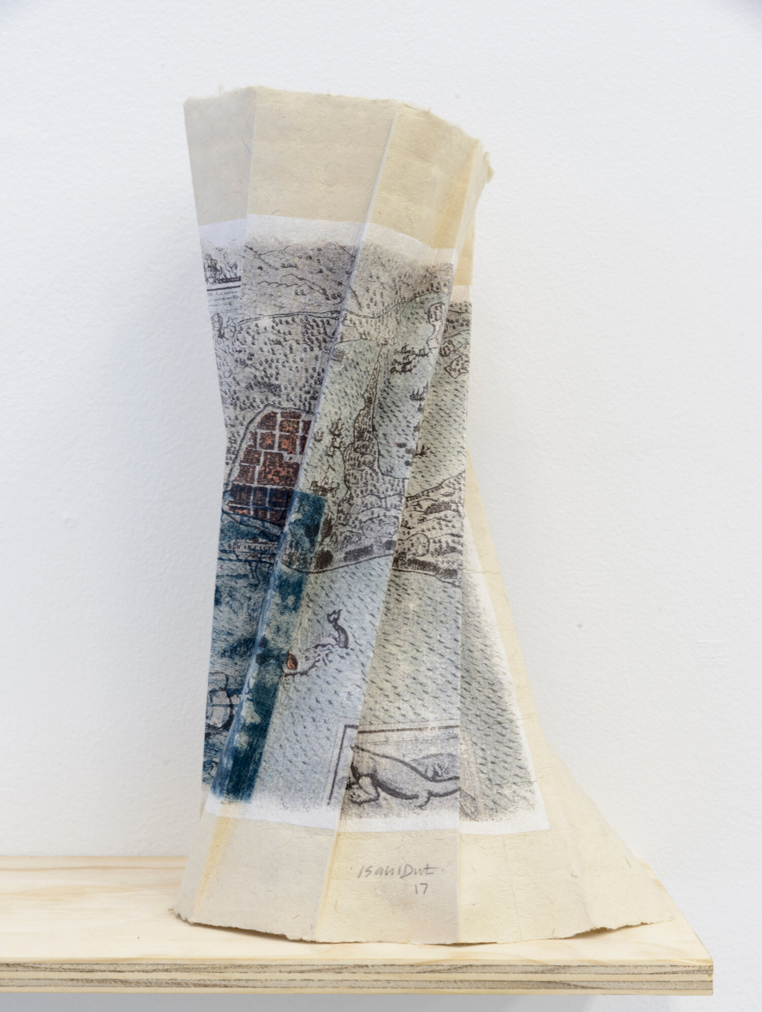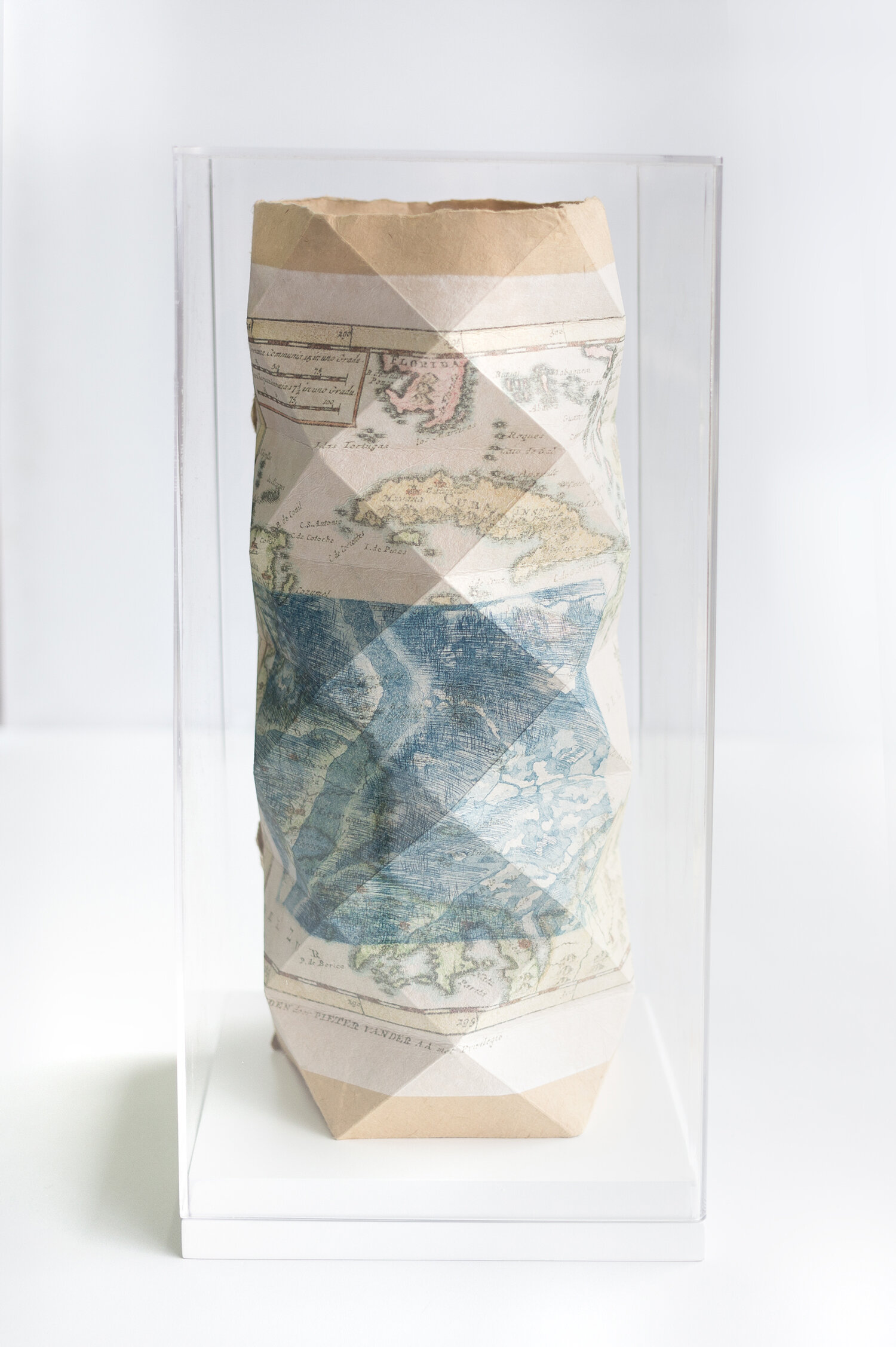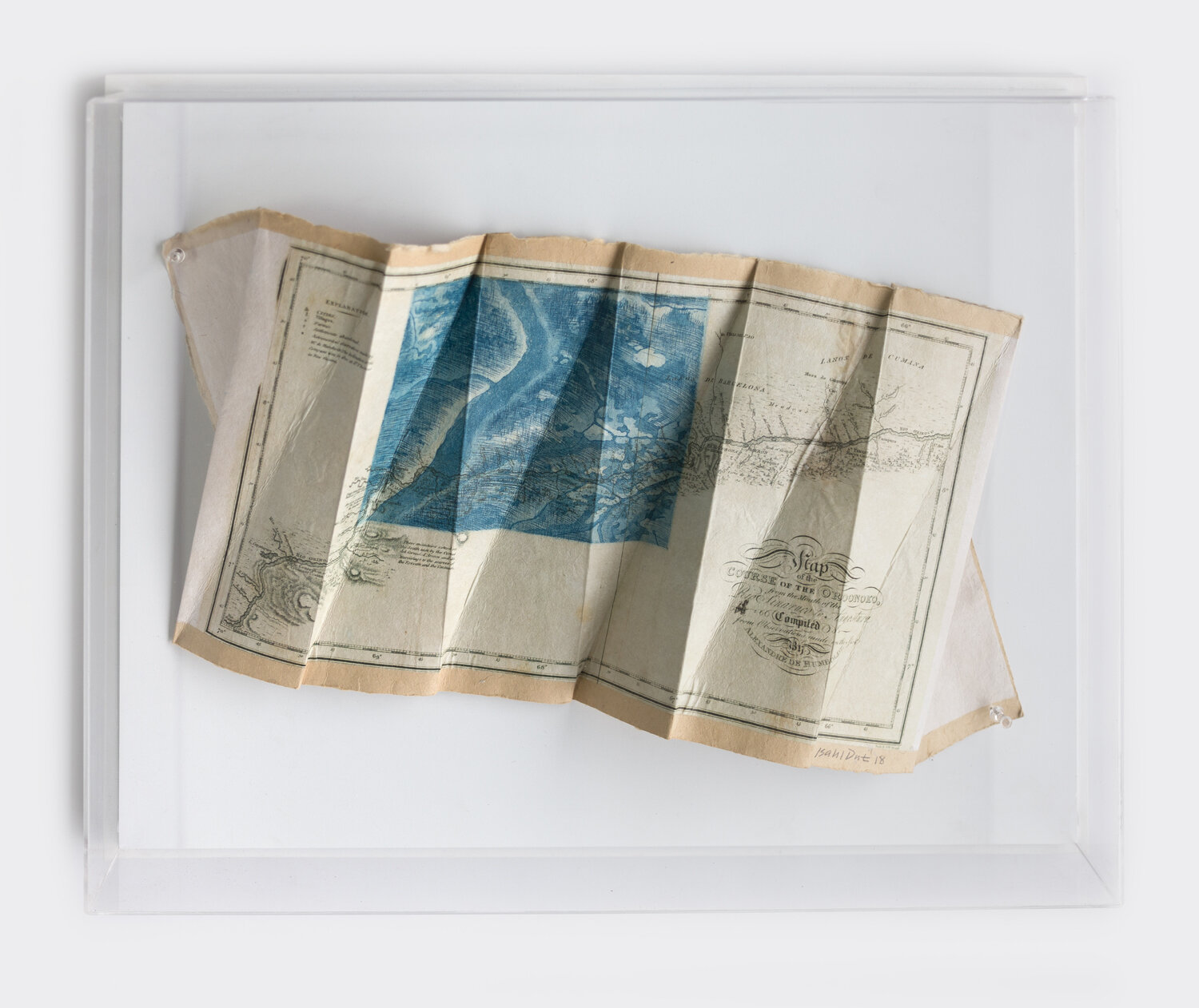
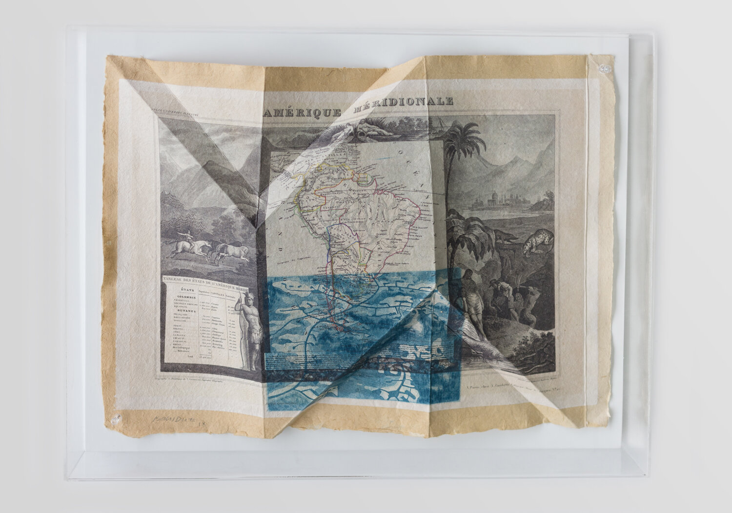

Origami sobre grabado (aguatinta y aguafuerte), chincollé con transfer de mapas antiguos en papel de arroz, sobre papel de fique. Caja acrílica y madera.
(In)creased Map
Topos-vision: exploratory processes of the territory
by Virginia de la Cruz Lichet
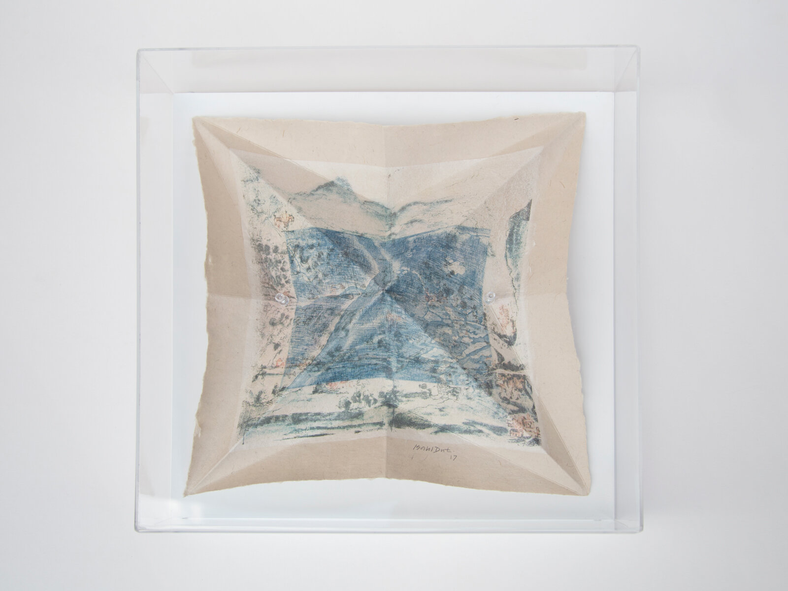
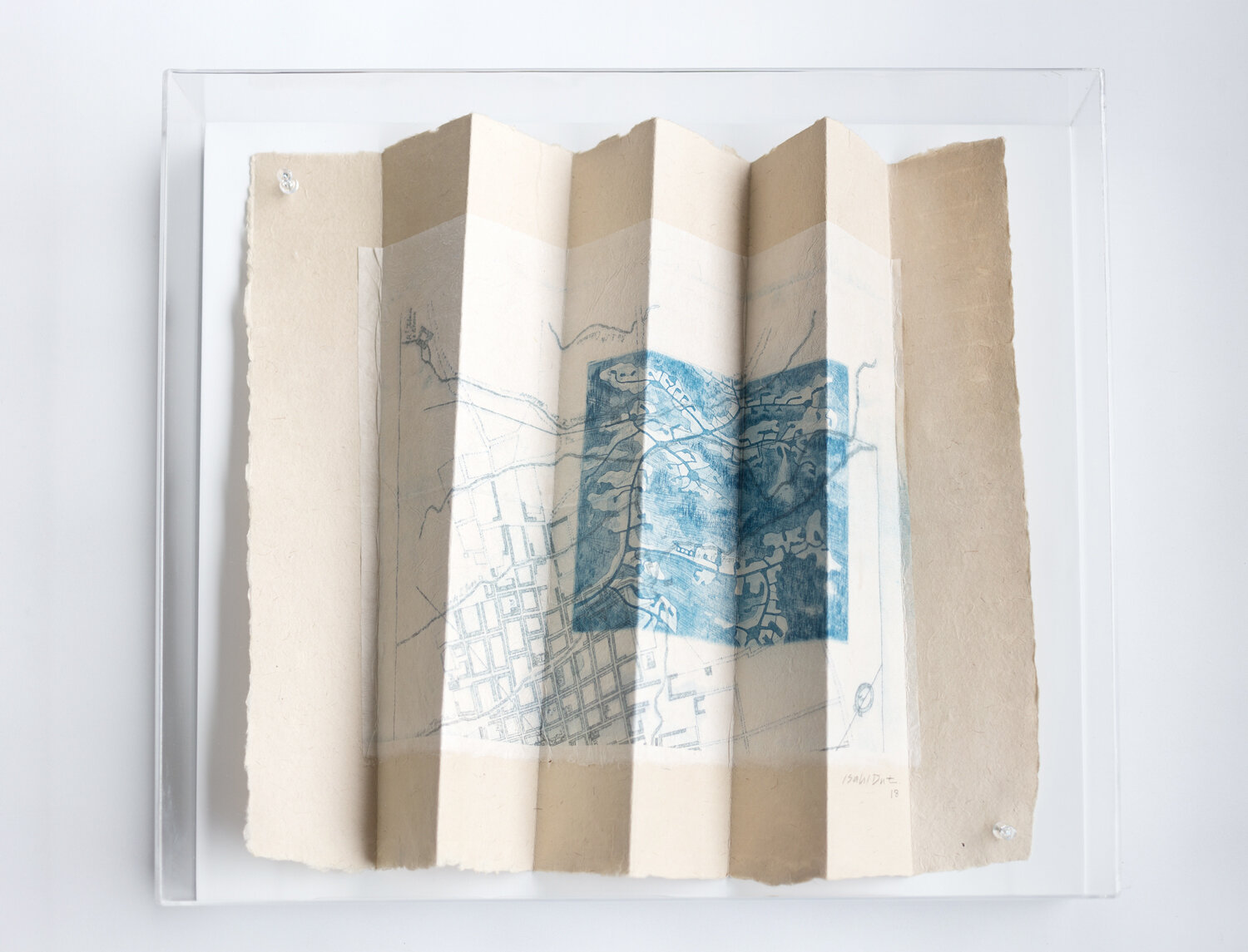
The way Ana Isabel Diez presents her (IN) Creased Maps series is interesting: maps that fold and unfold, giving rise to new organic sculptures that literally occupy the space of the frame or the pedestal.
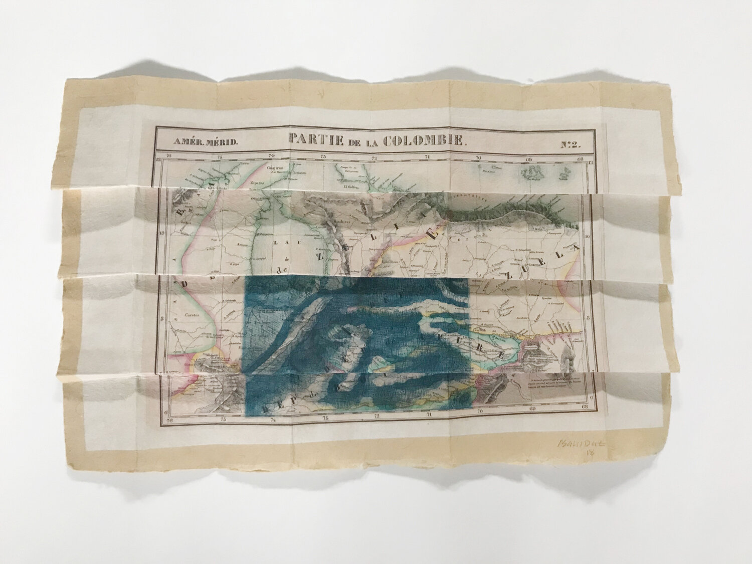
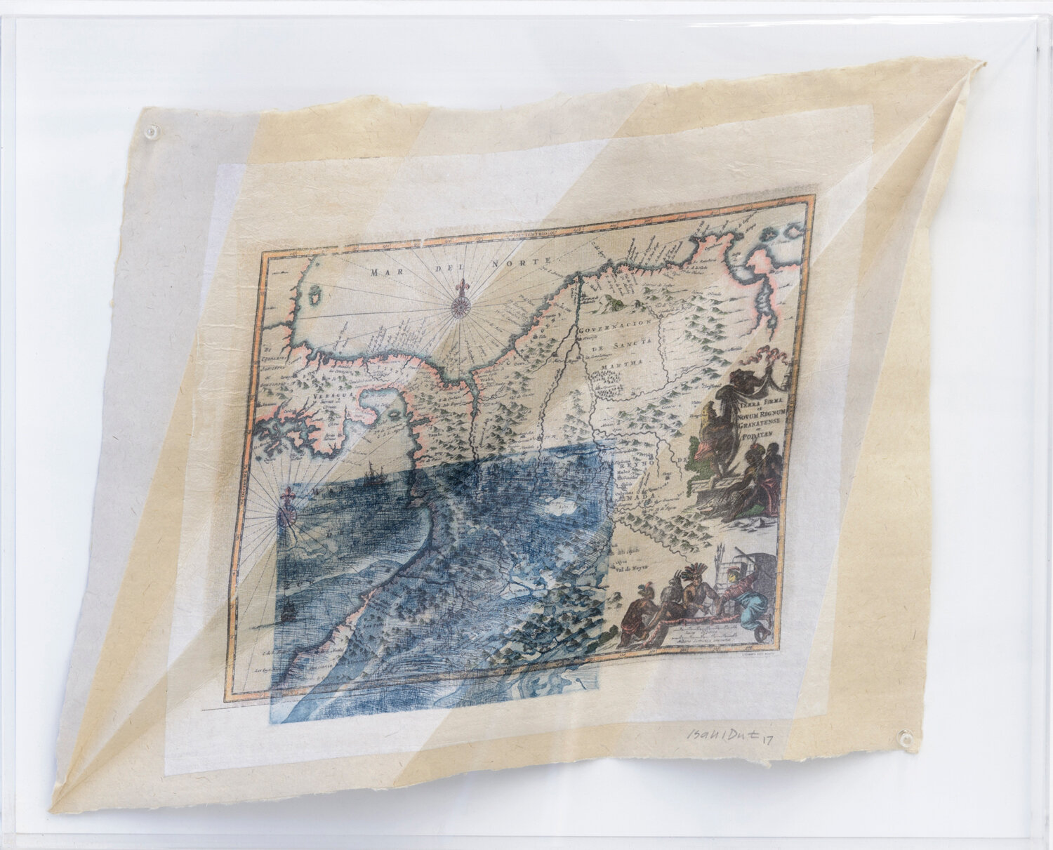
These aquatint and etching engravings, made from the combination of old and recent maps, result in a new mapping of the territory, hybrid, and which, at the same time, reveals a present impossible to explain without a colonial past that gave rise to the first cartographies of the American territory.
Although these engravings are already, in themselves, a reflection on the concept of "territory" and "identity" that is forged from that rooting with the earth, Ana Isabel Diez adds another transformative process, equally metaphorical: of folding.
But it is not just any folding, nor a wrinkling, not even a tearing, but the use of an ancestral folding technique: origami. The artist has deliberately chosen this technique, since it is a thorough, meditated, orderly and geometric folding that extends to infinity, thus responding to a mathematical model that is more familiar to us and that is repeated in the phenomena of Nature itself, as a fractal , beginning of everything and nothing, without beginning and without end. In this way, Ana Isabel Diez contrasts that plain of the bounded map surface with that other basic and fragmented geometric structure multiplied exponentially and that recomposes the space and territory represented.
The use of cartography that, by definition, represents and delimits a given territory, putting its focus on it, becomes a volumetric entity that by its folds delimits that same territory, dividing it into small faceted structures of a meandering and changing territory. At the same time, the folded map allows standing out illuminated areas and keeping others in shadow, thus highlighting the ravages of history, thus showing a past that has gradually or drastically transformed that territory, but also its darker areas.
These maps represent the traces of those wounds that remain and are recorded forever and ever, both on earth and on paper. The flatness of the map, that unique and hegemonic vision of the territory becomes a flush vision, to meet those folds that limit a centripetal look for another more exploratory and multifaceted, thus allowing new visual and conceptual combinations to be possible.
(In)creased Map
by Ana Isabel Diez
Context:
It is in human nature to move: trips, invasions, colonization, migration, exploration or anything of the sort. This has been a constant through out history among countries, cultures and continents. There is a need to go beyond. According to the moment in history in which the event takes place, or the geographical sense of the movement, its meaning changes: from enlightenment and civilization to forced migration and human trafficking; from slavery to revolution and back to slavery again; from powerful demonstrations to silent protests; from rich traditions to impoverished refugees; from north to south or east to west. There is a social transformation involved,
Migration is a crucial issue in today’s world. The unstable situation in many countries is causing people to flee, to even risk their lives, their families, their culture, their properties. They are decided to start all over again, no matter the price. Most of the time, they arrive in Colombia to start their trip towards “the American dream”. Refugees are growing in numbers every day. They overcome barriers, but borders don´t change. Cultures mix, cartographies juxtapose. A new geography is under construction.
The work:
I am interested in representing these movements with the dialogue of images through a combination of old and new maps.
The new maps are engravings (etching and aquatint), almost abstract images of unknown landscapes, printed over old maps of different geographies
On the other hand, there is origami, an ancient technique of folding paper, coming from the Far East. Here, the prominent crease is called mountain and the opposite is called valley. Jing and jang. The construction of the figure needs both. They continue to exist even after the figure is unfolded. These are the creased maps.
Origami figures are built with the maps. Then, they are unfolded and the marks remain on the paper, like the memories of the travelers that decided to carry out those voyages, through valleys and mountains, through water.